Greetings Everyone,
From the Albany area on the southern coast of Western Australia, we continued west toward Margaret River. We made a stop at Walpole-Nornalup National Park to visit the Valley of the Giants. A 130-foot high walkway had been constructed so you could get a bird’s eye view of these towering trees.
 |
| Tree Top Walk |
They are a species of Eucalyptus called Red Tingle (Eucalyptus jacksonii) and can grow to a height of 180-feet and live as long as 400 years!
 |
| Red Tingle Tree |
We reached the bustling town of Margaret River in the afternoon and located our accommodation, Bussells Bushland Cottages, about 4 kilometers away. We settled into our cottage nestled among native bushland for a 4-night stay.
 |
| Our Cottage Near Margaret River |
After dinner, we headed out for a night walk on the nearby trails. We saw Common Brushtail and Western Ringtail Possums, but unfortunately, we didn’t find a Brush-tailed Phascogale.
 |
| Common Brushtail Possum |
The next day we followed Caves Road south to explore some limestone caves found in the area. We stopped at the first cave, Calgardup and decided to visit it. We were given helmets and lights for the self-guided tour. The formations weren’t spectacular. At one section there was a low roof which forced us to crouch for 10 meters but it was nothing extreme, and we really didn’t need helmets.
 |
| Going Low Inside Calgardup Cave |
The next cave was called Mammoth owing to some enormous chambers. It was also a self-guided tour, but the cave was lit up so we didn’t need lights.
 |
| Mammoth Cave |
Our final cave was called Jewel Cave where we had to wait 20 minutes to go on a guided tour. You’re not allowed to go into this cave unguided. As we entered the cave our guide warned us about high CO2 levels and that we’d have to climb 500 stairs. This cave was discovered in 1957 and was opened to the public in 1959. It was the most impressive with a lot of calcite formations including the longest straw formation in any Australian cave. It was 5.4 meters long and was formed drop by drop over many years.
 |
| Straw Formations |
There were formations resembling coral, organ pipes, popcorn or cauliflower. There was a huge area of flowstone that resembled a karri forest and a massive stalagmite weighing some 20 tons!
 |
| Calcite Formation |
Our next stop was Cape Leeuwin Lighthouse. When we arrived the last tour was in 5 minutes and we rushed off to the lighthouse where Ron, our guide, and another couple were waiting.
 |
| Cape Leeuwin Lighthouse |
The tour allowed us to go inside the lighthouse and to climb the circular staircase to the top. Cape Leeuwin Lighthouse was built in 1895 to prevent further shipwrecks on the point where the Southern and Indian Oceans meet. Near the top was the chariot, the wheeled carriage at the bottom of the Fresnel lens assembly which allowed the lenses to rotate around a circular iron track. The lenses magnified the light from ~20 LEDs, allowing the light to be seen 40km away!
 |
| LED Lighthouse Light |
Ron opened the door and allowed us to go outside on the deck. The wind was blowing so hard we could barely make our way around the lighthouse.
 |
| Peggy on the Lighthouse Deck |
The view was stupendous over the boiling Southern and Indian Oceans.
 |
| Southern Ocean (left) and Indian Ocean (right) |
On the way back to our car a snake crossed our path. It was probably one of the venomous ones that the signs posted on the lawns warned visitors about. We asked the guy in the gift shop and he confirmed it was a Dugite (Pseudonaja affinis). The venom of the Dugite is potentially one of the most lethal in the world but they are not aggressive and tend to avoid humans.
 |
| Dugite |
We stopped at Cozy Corner to have a picnic supper and to watch the sunset over the Indian Ocean. We decided to return to Bussells Bushland by way of Boranup Road so we could do a bit of spotlighting for nocturnal animals. We saw Common Brushtail and Western Ringtail Possums and our second snake of the day, a South-western Carpet Python.
 |
| South-western Carpet Python |
The following day we chose to visit the Eagles Heritage Raptor Center, a facility that’s involved with the conservation and rehabilitation of injured raptors. We walked the 1-kilometer trail with cages containing various eagles, hawks, and owls in them. We arrived at the area where at 1:30 a flight display was to take place. The owner of the center came carrying a Barn Owl on his gloved arm. Her name was Ivy and she was born and raised at Eagles Heritage. She’s now 4 years old and her keeper explained all about her uncanny sense of hearing and eyesight. After he allowed us to hold her. It was a thrill to hold such a beautiful and gentle owl.
 |
| Peggy with a Barn Owl |
Ivy was returned to her cage and the owner let three Black Kites out of their cage. They flew around but seemed under his voice control. I’ve never seen birds kept in captivity exercised this way. The owner went on to explain that these kites are persecuted because it’s believed that they kill chickens. They are often referred to as chicken hawks but they eat insects and mice. He tossed them bits of food which they caught midair in their talons and Marc was able to capture a stunning photo.
 |
| Black Kite Catching a Morsel |
We had read that Indo-Pacific Bottlenose Dolphin often visit the bay around Bunbury so we made the 1-hour drive north the next day to search for them. We ended up at Leschenault Waterways to look for them. We walked a 1-kilometer causeway that led out into the bay, perfect for spotting dolphins but we saw none. We did see a lot of birds; cormorants, darters, herons, pelicans, gulls, and a Black Swan.
 |
| Australian Pelicans |
Marc called the Dolphin Discovery Center and they said the dolphins were there! We rushed off but by the time we got there maybe 10 minutes later they had moved off. To add insult to injury, we found out that the only boat tour to see the dolphins had left about 45 minutes ago. A couple of volunteers suggested we visit “The Cut” to see them and one volunteer gave Marc a map on how to get there. Before leaving, I bought tickets for tomorrow’s boat tour, the only sure way to see the dolphins. We drove around to “The Cut” where a few other people were looking for dolphins. Sure enough, they were there but were far away. We spent a couple of hours hoping to get a better view but we saw mostly dorsal fins.
 |
| Dolphin Dorsal Fin |
We returned to Bussells Bushland and that night I went out to inspect the West Australian Peppermint Trees Near our cabin. The leaves are the favorite food of the critically endangered Western Ringtail Possums. I spotted two feeding on leaves in the upper branches!
 |
| Western Ringtail Possum Near Our Cabin |
We left Bussells Bushland in time for our noon dolphin tour in Bunbury. We boarded the boat from the beach and stayed near shore while the captain gave us an informative talk about the dolphins. He confirmed that these are Indo-Pacific Bottlenose Dolphins, a different species than the Common Bottlenose Dolphin. A resident pod of about 50 have been studied in the bay for 20 years. We headed for “The Cut” where the dolphins tend to hang out and a pod was there frolicking in the water. A little boy on board kept crying “Shark, Shark!”. Their dorsal fins did look a bit shark-like. They approached our boat and we got excellent views and photos.
 |
| Pod of Dolphins |
We spent about 45 minutes with the dolphins. Toward the end of our tour, a newborn calf with its mom finally revealed itself. At this time of year, the dolphins are breeding and giving birth.
 |
| Mother and Calf |
We returned to shore and continued our drive to Mandurah where we stopped to visit our friend Sue before continuing north to Eglington our final destination.
We hope all is well with everyone.
Peggy and Marc
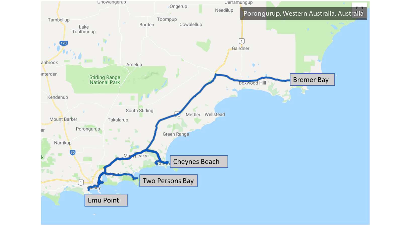
Our route map: