Greetings All,
We are a week into our next adventure in the Yukon and Alaska. We left home on June 11 and flew to Whitehorse in the Yukon by way of Chicago and Vancouver. We rented a SUV in Whitehorse for the 1000-mile or so drive to Fairbanks, Alaska. Here is a scene taken along the way to whet your appetite.
 |
| Boreal Forest |
From Whitehorse, a city of with a population of about 30,000 and the capital of the Canadian province of the Yukon Territories, we headed north along a short stretch of the Alaska Highway before veering onto the North Klondike Highway. Here is a map showing our route:
 |
| Our Route Shown in Yellow |
Not far from Whitehorse is the Yukon Wildlife Preserve. We stopped in to view some of the wildlife we were likely to encounter on this trip. The Preserve is home to Wood Bison, Thinhorn Sheep, Mountain Goat, Canada Lynx, Arctic Fox and several more species. We were able to spot all the wildlife species in the Preserve as they are confined in large enclosures.
 |
| Wood Bison |
We also had some nice waterfowl viewing in ponds along our walk in the Preserve.
 |
| Horned Grebe |
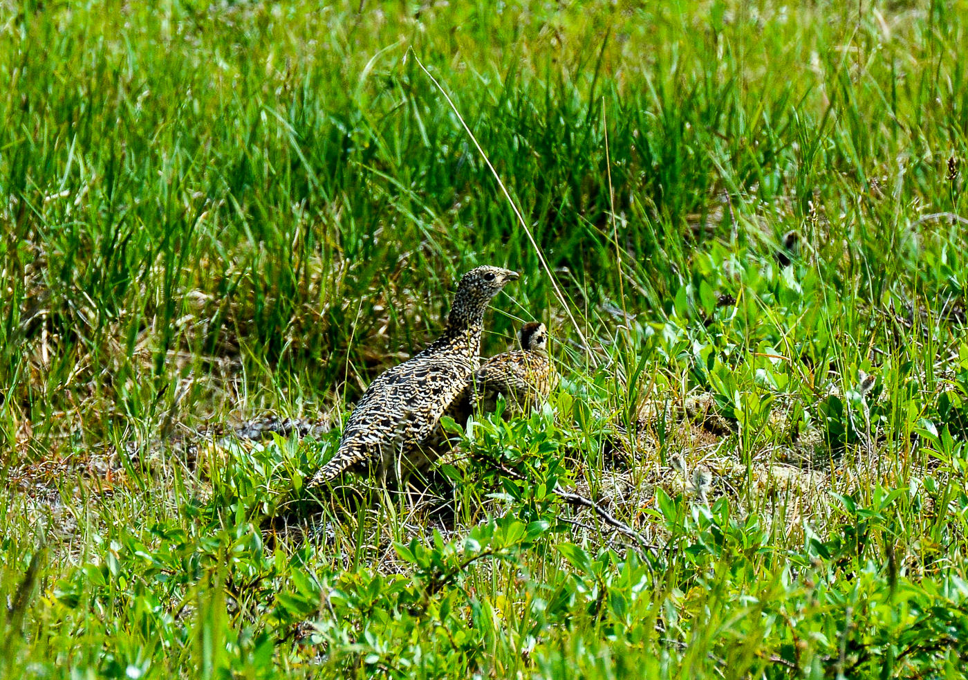
Now that we had seen the animals that inhabit the boreal forests of the Yukon and Alaska we were eager to seek out them out in the wild. We spent our second night at Carmacks along the Yukon River and the next day continued our drive north toward Dawson City. We decided to take a detour and explore a 25-mile stretch of the Robert Campbell Highway and the Tatchun/Frenchman Road. This gravel road took us 26 miles past 3 lakes: Frenchman, Nuntuk and Tatchun. We didn't encounter much wildlife but a female Spruce Grouse with 5 tiny chicks tucked under her feathers was a pleasant surprise.
 |
| Spruce Grouse with Chicks |
We also saw 2 Bald Eagles at Tatchun Lake where they may have been nesting.
 |
| Bald Eagle |
We rejoined the Klondike Highway and continued north to Dawson City, the terminus of the highway. Dawson City was the center of the Klondike Gold Rush. It began in 1896 and changed a fishing/hunting camp into a thriving city of 40,000 by 1898. By 1899, the gold rush had ended and the town's population plummeted to 8,000 people. Today most of Dawson's buildings have the 19th century construction appearance but draw tourists not gold seekers.
 |
| Dawson City |
We had an extra day in Dawson City so we decided to explore part of the Dempster Highway. This gravel road starts about 25 miles south of Dawson City and covers 457 miles to the village of Inuvik on the Mackenzie River Delta. The highway traverses Tombstone Territorial Park and we stopped to hike to Mt. Monolith Lookout. We were the first to arrive at the trailhead and I was a bit apprehensive hiking a trail by ourselves that was named the Grizzly Creek Trail. We didn't have pepper spray so had to shout along the way to alert bears to our presence. It was great finally getting into the boreal forest. The boreal forest also known as the taiga is the worlds largest terrestrial biome and is characterized by coniferous forests of pine, spruce and larch.
 |
| Boreal Forest |
Once we climbed out of the forest and could see a little further, I relaxed about encountering a bear. The only wildlife we hadn't scared away with our calls of "humans coming through, don't be alarmed!" were the Hoary Marmots and Arctic Ground Squirrels.
 |
| Hoary Marmot |
We reached the first viewpoint and decided to continue along the ridge to a saddle from which we could get a view of Grizzly Lake.
 |
| Grizzly Lake |
We turned back at this point and retraced our route back into the forest. By this time other hikers were making the climb and our chances of scaring a grizzly bear were slim. We safely returned to our vehicle and continued north along the Dempster Highway. I spotted a dark black shape on a hillside about a quarter of a mile away. When we stopped to investigate we saw that it was a Black Bear!
 |
| Black Bear |
We ventured out 140 miles along the highway before turning back. We needed to make sure we had enough gas to get back to Dawson City. We didn't encounter much more wildlife except for 4 Dall Sheep spotted by a local family returning home to McPherson (another 5 hours north) and a porcupine ambling across the road.
 |
| Dall Sheep |
 |
| Porcupine |
We didn't get back to Dawson City until 9:00 PM but with the sun not setting until midnight it didn't really matter. The next morning we had to cross the Yukon River by ferry. We were the last to arrive but got on first because we were in a smaller vehicle.
 |
| Ferry Crossing at Dawson City |
We were now on the Top of the World Highway, a gravel road that would take us across the border into Alaska. We got stuck behind a large RV towing a jeep. They signaled for us to pass and when we did, a cow moose with twin calves was on the road in front!
 |
| Moose and Calves on the Highway! |
We didn't want to pass them but couldn't stop as the RV was on our tail. We followed the moose family for about a half mile down the road before they veered off into the forest. In the distance we could see the border station between Canada and the United States. Would they confiscate our cheese and lemons?
 |
| Border Crossing |
Our "detour of the day" was to the tiny outpost of Eagle at the end of a narrow, winding 65-mile gravel road called the Taylor Highway. We dropped from a high ridge and re-entered the boreal forest. An animal shoots across the road. "Badger!" Marc shouts. "No, a wolverine!" I exclaim. It was too quick for a photo but it was definitely a wolverine, the largest member of the weasel family. They are highly secretive and rarely seen. How lucky for one to finally cross our path! We encountered a second cow moose and a third with a single calf before arriving in Eagle.
 |
| Another Moose with Calf |
Eagle is situated on the Yukon River and during the late 1800's people were drawn to the area by the Klondike Gold Rush. A United States Army Camp, Fort Egbert was built in 1900.
 |
| Fort Egbert |
A telegraph line between Eagle and Valdez was completed in 1903. In 1905 Roald Amundsen arrived in Eagle and used the telegraph to tell the rest of the world of his discovery of the Northwest Passage! We returned to the junction of the Top of the World Highway and Taylor Highway and continued along the Taylor highway to the community of Chicken, a very unusual place where chickens and roosters are the theme.
 |
| Peggy in Chicken, Alaska |
You can pan for gold in the parking lot but we opted for burgers and wine instead. The next day we left Chicken and drove along the Taylor Highway to Tetlin Junction where we picked up the Alaska Highway. Just beyond the town of Tok we stopped at a pond to check out 3 Trumpeter Swans. This was the closest we've been able to get to these birds. I was checking out my bird book when two of the swans started to make a ruckus with a lot of wing beating and squawking. I can't say we've ever seen Trumpeter Swans mating before!
 |
| Mating Trumpeter Swans |
We continued along the Alaska Highway to Delta Junction where we spent the night. The next morning we went in search of a bison herd that lives in the area. We drove for about 40 miles south of Delta Junction on the Richardson Highway. We didn't find the bison but had plenty of views of the Alaska Range and Mount Denali, the highest peak in North America!
 |
| First View of Denali |
We returned to Delta Junction and the Alaska Highway and drove another 95 miles north to Fairbanks. Traffic along this stretch of the highway is heavier but we managed to spot a Pine Marten crossing the road! It was another secretive member of the mustelidae family that we were lucky to see. We are now in the city of Fairbanks, Alaska for a few days before starting a raft trip through the Arctic National Wildlife Refuge on June 19. While here we've discovered that Fairbanks is the terminus of the 1000-mile Yukon Quest International Dog sled Race from Whitehorse.
 |
| Yukon Quest Route |
Our route had pretty much copied the Yukon Quest route with one major difference, we traveled in a comfy SUV during the warm summer months with ample sunshine. Nonetheless, traveling through the scenic boreal byway from Whitehorse to Fairbanks was an exciting start to our 6-week adventure. We can't wait to see what's in store for us in the Arctic National Wildlife Refuge! Stay tuned.
We hope all is well back home,
Peggy and Marc