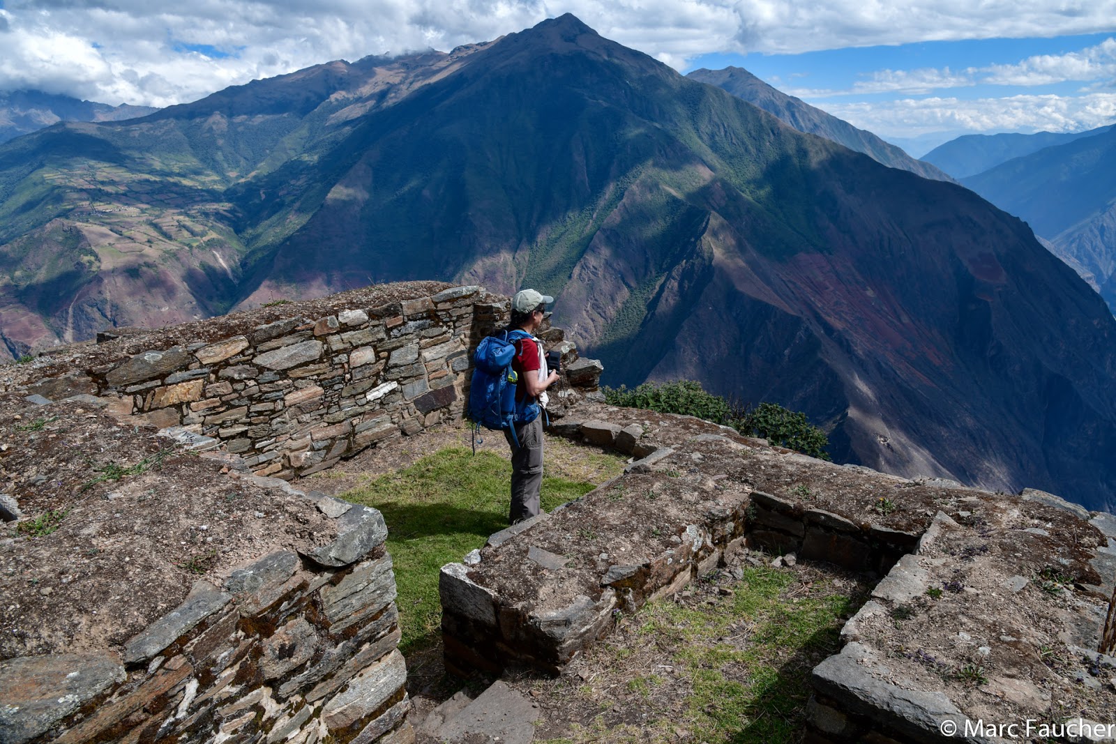
Greetings Everyone,
We are in the South American country of Peru on a 9-day trek from the Incan ruins of Choquequirao to Machu Picchu. We’re more than halfway through our trek and about ready to climb to the high mountain passes separating us from our destination. Our first objective was San Juan Pass, a 4100-foot ascent from Maizal through bamboo and lupine forest. The trail was mucky and the views obscured by lingering clouds but we made good progress up to Victoria Mine and stopped to wait for the rest of our group. An open shaft led to an abandoned silver mine that had been worked for over 1000 years! Marc and I donned our headlamps and crouched to avoid hitting our heads on the low ceiling. We didn’t venture too far inside, stopping at a junction where the roof was held up by an old wooden beam.
 |
| Inside Victoria Mine |
We returned to the outside just as the others were arriving. Nearing the pass, two Andean Condors soared overhead. From a rocky outcrop at around 13,500-feet we were hoping to see spectacular views of the Cordillera Vilcabamba but only got glimpses of the peaks between the clouds.
 |
| Views of the Cordillera Vilcabamba |
Descending into the Rio Yanama Valley, the trail was lined by lupines that grew to the size of small trees!
 |
| Lupine Bushes |
Our camp had been set up in the yard of a local family in the village of Yanama. Big changes are coming to this valley. A gravel road has now been constructed to the town and will be built further all the way to Maizal. It will certainly make life easier for the locals but will change the peaceful way of life that now exists here.
 |
| Camp at Yanama |
Our trek group left Yanama early the next morning and followed the road before veering off on a trail. The climbing became steeper as it approached Totoro Pass. We reached a viewpoint of the Cordillera Vilcabamba and could see the peaks of Sacsarayoc, Pumasillo, and Choquetecarpo.
 |
| Peaks of the Cordillera Vilcabamba |
Our group paused for a photo including Froilan and his horse Raul who was accompanying us. Raul was carrying extra water and we referred to him as “the water horse”.
 |
| Robin, Mark, Chris, Peggy, Marc, Froilan and Raul (L-R) |
Victor scrambled straight up but we stuck to the trail with switchbacks. He stopped at the high point around 15,300 feet but Marc and I went ahead to get a view of Salkantay before it disappeared into the clouds. At 20,574 feet, Salkantay is the highest peak in Vilcabamba Mountain Range.
 |
| Salkantay Looming Above Tortora Pass |
Now for the 4600-foot descent on alternating sections of trail and dirt road until our arrival at Hornopampa where a bridge crossed the river.
 |
| Descending from Tortora Pass |
Beyond Hornopampa lay the village of Totoro, our camp for the night. The woman who owned the campsite was busy weaving scarves from Alpaca wool. I purchased one and Chris bought two making her very happy.
 |
| Alpaca Scarf Weaver in Tortora |
The next morning our trek 'family' said goodbye to the horsemen: Froilan, Robert, and Flavio as they were returning to Yanama and a bus would deliver our duffel bags to the next campsite. We followed the road taking a few short trails to cut a switchback or two and had our final views of Salkantay before it disappeared near the junction with the more popular Salkantay Trek.
 |
| Last Views of Salkantay |
Our group left the road for good, following a path down to the Santa Teresa River and crossing a bridge near some hot springs. Victor spotted some birds in the trees along the undulating trail through the cloud forest. It was a pair of Masked Trogons and Marc was able to get some photos.
 |
| Masked Trogon |
Around 1:30 we reached a second bridge, recrossed the river and climbed back up to the road where 3 minivans were waiting. We found ours, climbed in, and rode for about 35 minutes to Lucmabamba where a private camping site awaited us. It was very nice with a dining room, clean bathrooms, and a camping area.
 |
| Lucmabamba |
Victor had scheduled a coffee tour for later that evening but the guys were distracted with soccer. There was a TV in the dining area and Brazil was playing Argentina. The winner would play either Peru or Chile in the semifinals of the Copa América soccer tournament. We had popcorn and our first beer of the trek. It was getting dark so I set off on the coffee tour forcing the guys to follow. The tour was given by a local man named Wilfredo who led us up some stone steps along which coffee plants were growing, reaching a building where the picked coffee beans were washed, the husks removed and then dried for 15 days.
 |
| Wilfredo Showing Coffee Trees |
Our group returned to the dining area and in an adjoining room where Wilfredo showed us how the final husk was removed and the beans were roasted over a wood fire in a clay pot. We took turns stirring the beans constantly for about 20 minutes. It’s a small operation where everything is done by hand. The final product is sold to tourists or to a cooperative. Wilfredo’s wife roasts about 10 kilograms or 30 batches of beans per day!
 |
| Marc Roasting Coffee |
Once the beans were roasted they were ground. The final step was to “brew” the coffee in a porcelain pot. Hot water was poured over the coffee and allowed to drip through a filter. Wilfredo said that this part of the process can not be rushed or the coffee will be ruined and all work previously done wasted. Sampling the coffee, it was very strong, more like espresso. Dinner was served after and the guys stayed up later to watch the end of the soccer game. Marc and I went to bed, drifting off to sleep as the guys cheered for Brazil or was it Argentina?
 |
| Wilfred Brewing Coffee |
Today was the last day of our trek. When I went to breakfast, Juan, our chef, had prepared us a farewell cake!
 |
| Juan with Farewell Cake |
After breakfast, we said goodbye to Juan, David, and Hilario. I will miss their smiling faces and willingness to make us happy. Our now smaller group headed out and climbed up and up encountering many more trekkers as this part of the trail was on the popular Salkantay Trek. Following an ancient Inca trail to the top of the ridge, we had our first views of Machu Picchu from the back of the Inca citadel, a sight few visitors see.
 |
| First Views of Machu Picchu |
Just below was Llactapata, an Inca site that has only recently been excavated. An archeological study concluded that the location of Llaqtapata along the Inca trail suggested that it was an important rest stop and roadside shrine on the journey to Machu Picchu. It may have also served as a communication post as signals could have been sent to Machu Picchu via mirrors, smoke, flags, fires or blowing conch shells.
 |
| Ruins at Llaqtapata |
We then descended steeply into the Urubamba Valley all the way down to the river and the train station at Hidroeléctrica. A short ride to Aguas Calientes took longer because the train had to keep backing up to gain elevation. I was shocked! When we visited here 28 years ago, Aguas Calientes was just a train stop where the locals would sell produce or handicrafts to the few tourists who dared venture here. 1991 was the height of the Sendero Luminoso, a communist rebel group whose activity has declined in recent years. Now Aguas Calientes is a bustling tourist town with hotels, restaurants, fancy stores, bars, and coffee shops to cater to the thousands of tourists that visit Machu Picchu daily. I have to admit a hot shower and comfy bed felt good after 9 days on the trail.
 |
| Aguas Calientes |
The festivities from Peru beating Chile in the semifinals of the Copa América soccer tournament lasted most of the night. The music, drum beating, fireworks and chanting finally ended at 4:40 am. When I looked out the window there was a long queue for the first bus to Machu Picchu. I hoped the line would diminish as the morning wore on. Around 9:30 we went to join the bus queue. It had not gotten any shorter if anything it had grown longer.
 |
| Bus Queue for Machu Picchu |
Finally, we made it to the front of the queue and boarded a bus. It was now 10:30. About 30 buses or so run continuously throughout the day each bringing 30 passengers to or from Machu Picchu. Until recently as many as 5000 people a day visited Machu Picchu during the high season but the number of visitors permitted on a daily basis has now been capped at 2,500. The bus climbed the steep switchbacks to the end of the road where a luxury lodge now exists. It was a bit chaotic exiting the bus but once through the gate, there was less congestion. Victor suggested we visit the Sun Gate first. It was a good move as few people make the 45-minute climb along the Inca Trail to the Sun Gate (Intipunku).
 |
| At the Sun Gate |
We didn’t visit the Sun Gate in 1991 so I was keen to make it this time. Two stone gates here correspond to the all-important winter and summer solstices; on those dates, the sun’s rays illuminate the gates like a laser. The view from the gate was stupendous!
 |
| View of Machu Picchu from the Sun Gate |
We returned to where Victor was waiting for us and next visited the Inca Bridge, another place we missed on our 1991 visit. West of Machu Picchu, the Inca Bridge, built upon stacked stones and overlooking a sheer, 600m (nearly 2,000 ft.) drop was critical to the citadel’s defense. Logs were placed across a gap in the stone wall which could be pulled away if an enemy was approaching. Today, a gate prevents tourists from crossing the Inca Bridge and continuing on.
 |
| Peggy near the Inca Bridge |
We returned to the main site just below the Caretaker’s Hut to take more photos of Machu Picchu, this time with llamas in the foreground.
 |
| Llama at Machu Picchu |
By now the crowds had diminished and it was time to visit Machu Picchu itself. We entered the main gate and visited the Temple of the Sun (also called the Torreón). The rounded, tapering tower has extraordinary masonry with its large stones seamlessly fitting together. From the ledge above the temple, there is a window perfectly aligned for the June winter solstice when the sun’s rays come streaming through at dawn and illuminate the stone at the center of the temple. We were too late for the winter solstice but Marc spotted what he thought was a rabbit sitting in the window. It was actually a Mountain Viscacha!
 |
| Mountain Viscacha at the Temple of the Sun |
Continuing to the Sacred Plaza comprised of the Temple of the Three Windows, the Principal Temple and the House of the High Priest, we saw fountains still functioning, the quarry from which stone was taken to build the site and reflecting pools of water used for astronomical observations. We had been hesitant to return to Machu Picchu as it would be difficult to top our 1991 visit and were concerned that the high number of visitors would have damaged the site and diminish the experience. However, Machu Picchu is as spectacular as ever and is well-cared for.
 |
| Central Plaza at Machu Picchu |
We left around 4:00 to catch a bus back down to Aguas Calientes and walked to a restaurant for an early dinner. It was a crazy scene with the train tracks running through the center of town! It’s the only way in or out.
 |
| A Train Running Through Aguas Calientes |
After dinner, we went to the train station where our duffels were waiting. I slept off and on during the 2-hour train ride to Ollantaytambo. The train rocked to and fro in sections. Around 8:00 the train reached the end of the line and we had to carry our duffels to where a bus was parked. Another 2 hours on a mix of paved and gravel roads through small towns brought us to Cusco. We said our final goodbye to Victor and turned in around 11:00. It had been a long but very rewarding day, a fitting end to an amazing trek!
 |
| Our Trek 'Family' |
A heartfelt thanks go to our wonderful guide Victor whose passion and knowledge of Peru he expertly shared with us each day. A big thank you to Juan our chef whose meals were not only delicious but beautifully presented. We were also very grateful to David and Hilario who helped Juan prepare and served our food and to our horsemen Froilan, Robert, and Flavio who transported our gear and helped to set up camp. Without their support, it would have not been possible to do this trek with its spectacular scenery, archeological treasures and village life!
We hope all is well with everyone.
Peggy and Marc
Our route map: