Saturday, November 02, 2013

Yaks Gone AWOL

Greetings All,
Yippee!!!  We woke to clearing skies and would be leaving Laya today!  Another trekking group had left Laya the day before and we hoped they would break trail over the next pass.

Laya Under Clear Skies

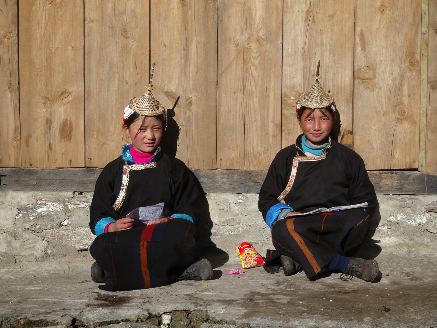
As we were heading out, two schoolgirls with the traditional conical bamboo hats that Laya is known for agreed to let us take their photo.


School Girls in Laya
 
As a result of the storm, Trek Groups piled up in Laya.  We were now on the same schedule as a group from France.  Some of our staff raced ahead to secure the trekkers' hut at Rodophu before the French arrived.  The hut was smoke filled so, we were happy to camp outside.  We did use one of the less smoky rooms in the hut to eat our meals.  A woman from Laya peered in through one of the windows offering to sell me a conical bamboo hat.  Of course I couldn't resist.
 
Laya Woman at Rodophu
 
Thanks to the group that was a day ahead of us, the snow that had fallen on our 5th pass, the Tsome La, had been well packed.
 
Us on the Tsome La, I'm wearing my new hat 


I'm amazed at how agile our pack ponies and mules are!  They are able to carry heavy loads over steep, slippery and rocky terrain wearing metal horseshoes!

Pack Ponies Crossing the Tsome La 

Descending from the pass we stopped at a flattish but snowy spot for lunch.  The sun poked through the clouds warming us.

Lunch below the Tsome La 

Yes, we were very pampered on this trek!  Our camp staff set up a table and chairs and served us a hot meal at every lunch.
 
We spent a cold night at our highest camp yet around 16,000 feet in preparation for crossing the Karakachu La at nearly 17,000 feet.  There were still lots of clouds around so the view was somewhat obscured.
 
Crossing our 6th pass, the Karakchu La 
 
It was a long knee-crunching descent to the Tarina Valley far below.  At least the spectacular views of turquoise lakes at the head of the valley distracted me from my aching knees.  
 
Lakes at the head of the Tarina Valley
 
We arrived at camp around 5:00, 9 and a quarter hours after we had set off in the morning.  Our pack ponies had arrived but where were the yaks?  We were now using around 13 yaks to carry loads over the high mountain passes.  Fortunately, the ponies carried all our stuff but the yaks had all the staff's gear.  It would be a cold night for them.  We offered some of our equipment but they would make do sleeping in the mess tent with pony blankets.
 
We turned in around 8:45 and still no yaks. 
  
We hope all is well back home.
Peggy and Marc

Friday, November 01, 2013

Hunkering Down in Laya

After leaving Jangothang the weather remained clear and we had spectacular mountain views from the summit of our first pass, the Nyele La at 15,900 feet.

Us on the Nyele La, our first Pass Crossing

Jitchu Drake is on the left and Tserim Gang is on the right.  As we descended from the pass we could see Lingshi Dzong perched strategically on a hill above.

Lingshi Dzong

Built in the 16th century by Zhabdrung, the lama responsible for unifying Bhutan, the Dzong is now falling to ruins after being damaged by the September 18 earthquake last year.  All monks living there had to move.

We dropped back down into rhododendron forest and camped next to the Lingshi Chu (River).  The following morning we climbed up to inspect the crumbling Lingshi Dzong then back down to the village of Lingshi.  As we approached we could see that an archery match was underway.  Men from the village of Lingshi were taking on rivals from the neighboring village of Gang Yul.  The Bhutanese take archery very seriously.  The match will go on all day with lots of singing and dancing when an archer hits the target and lots of beer drinking to improve aim.  New fangled bows from the US are now in vogue.

Archer in Lingshi
 
We descended to the tiny village of Gang Yul situated beneath enormous limestone cliffs and dwarfed by the massive east face of Tserium Gang.

Gang Sul at the base of Tserim Gang

The village was mostly deserted as most of the inhabitants were in Lingshi at the archery match.  A lone old woman spun her prayer wheel in quiet reflection.

Old Woman Spinning Prayer Wheel

We ended the day camping at the village of Chebisa in a yak pasture with lots of barking dogs at night.

Our Camp at Chebisa
 
Three more pass crossings brought us to Laya, the largest village on the trek.  As we entered the village, it started to rain.

Entering Laya

It was at this point we found out that a super cyclone from the Bay of Bengal was bearing down on India.  A massive wall of moisture was heading north into Nepal and Bhutan.  The rain continued throughout the night and through the next day.  Fortunately, the following day was a rest day and we could wait out the storm.  The rain did not stop and the next morning it had changed to snow! 

Snowy Camp at Laya

Our staff tried to cheer us up by building a beer-drinking snowman, very appropriate for the aptly named Snowman Trek.

Snowman in Laya
 
The decision was made to spend another day in Laya to see if the storm would abate.  At this point our trek was in serious jeopardy.  We may be forced to retreat to the road head at Gasa and miss going to Lunana all together.  My spirits sank and I prepared myself for the inevitable.  How could we proceed?  Even if the storm blew over surely it would leave lots of snow on the high passes. Could we or more importantly our pack animals make it over the snow clogged passes?  Only time would tell.

We hope all is well back home.
Peggy and Marc

Tuesday, October 08, 2013

Chomolahari, Divine Mountain Goddess

Greetings All,
It is Day 4 of our trek.  We are trekking with a group of ten, 7 from the UK, 2 from the USA (us) and 1 from Australia.  There are 8 men and 2 women in our group.  We are supported by a Bhutanese guide, an assistant guide, a cook, 2 kitchen staff, 3 camp staff and 5 horse men.  All our gear, food, fuel, tents, trek bags, tables, chairs and kitchen gear is being carried by 38 pack ponies and mules.  It is quite an undertaken to bring 10 people on a 26 day trek into such remote areas.

Our Lead Pack Mule

We spent the first 2 days climbing through a cloud forest with massive pine trees draped in Spanish Moss, ferns and lichen.  

Spanish Moss or Old Man's Beard

The weather was not cooperative with cloudy skies and rain showers.  The trail climbed along the Paro River which we crossed on log bridges adorned with Buddhist prayer flags.  

Peggy on a Bridge Crossing the Paro River

 We hopped from rock to rock to avoid the worst of the thick mud.  We're currently camped at Jangothang at 13,200 feet.   


Breakfast at Jangothang

We were at this spot 21 years ago when we did the Chomolohari Trek!  The first 5 days of the Chomolarhari Trek coincide with the Snowman Trek which we are doing now.  A lot has changed in 21 years.  There are more people living in the valley, more trekkers and cell phone coverage at this camp!  This morning the weather finally cleared and we were treated to a view of the massive east face of Chomolohari (23,997 feet) Bhutan's sacred mountain. The peak straddles the Bhutan/ Tibet border and has been climbed only 6 times.  It is forbidden to climb Chomolohari from Bhutan as it is believed to be the abode of one of the female protector goddesses (Jomo) of Tibet and Bhutan.


East Face of Chomolohari, a ruined Fortress s in the foreground


In front of Chomolohari are the ruins of an ancient fortress.  Out guide Namgay told us the legend  behind the Dzong.  Long ago the king of this region ordered his subjects to remove the top of the ridge that was blocking the morning sun.  The people started this formidable task but soon revolted, killing the king.  The fortress was abandoned and fell into ruin.  


Today we did an acclimatization hike to prepare us for our first pass crossing tomorrow.  We hiked 1200 feet above camp to two lakes and an impressive view of Jitchu Drake.  From this angle the pyramidal shape of Jitchu Drake is unmistakable.

Marc and Peggy with Jitchu Drake in the Background
 
That's it for now.  Bandwidth is limited.  
We hope all is well back home.

Peggy and Marc 

Thursday, October 03, 2013

Land of the Thunder Dragon

Greetings All,
Our next adventure has begun!  After flying nearly 22 hours (not all in one shot) we arrived in Bangkok, Thailand on September 30.  We visited Bangkok 22 years ago and ventured into the city to visit The Grand Palace to see how much it had changed.   I was shocked at the number of fellow tourists we encountered.   I remembered few visitors to this wildly ornate complex back in 1992.  Construction of a new palace and administrative offices began back in 1782 by King Rama I.  On the Upper Terrace are four main monuments including a large golden stupa on the near left, Phra Siratana Chedi.  Behind and to the right are Phra Mondop and The Royal Pantheon which contains statues of past kings.

Upper Terrace Monuments

Tall Guardian Statues stood by the entrance to the main gate.

Guardian Statue

The most famous temple is the Royal Monastery of the Emerald Buddha.  The Emerald Buddha is in fact carved from a block of green jade and was first discovered in 1434 in a stupa in northern Thailand.  At that time the stature was covered in plaster.  An Abbott noticed that the plaster on the nose had flaked off revealing the green stone underneath which the Abbott thought was emerald.  Back in 1992 we could photograph the Emerald Buddha but not this time around.  You'll have to settle for a row of golden deities that line the exterior of the monastery.

Golden Deities

On the morning of October 2, we flew from Bangkok to Paro, Bhutan.  The valley was shrouded in clouds and our pilot had to abort his attempt to land from the north.  The approach from the south had slightly more visibility and our pilot was able to thread through the mountains at the entrance to the valley and land safely, whew!

Flying in to Paro, Bhutan

We were saddened to learn that The National Museum had been severely damaged by a magnitude 6.1 earthquake in 2009 and is now closed.

Earthquake damage to the National Museum

We had visited this museum back in 1992 but fortunately a new building has been constructed to house Bhutan's artifacts.  We also visited the Paro Dzong or fortress/monastery built back in the 15th century.

Paro Dzong

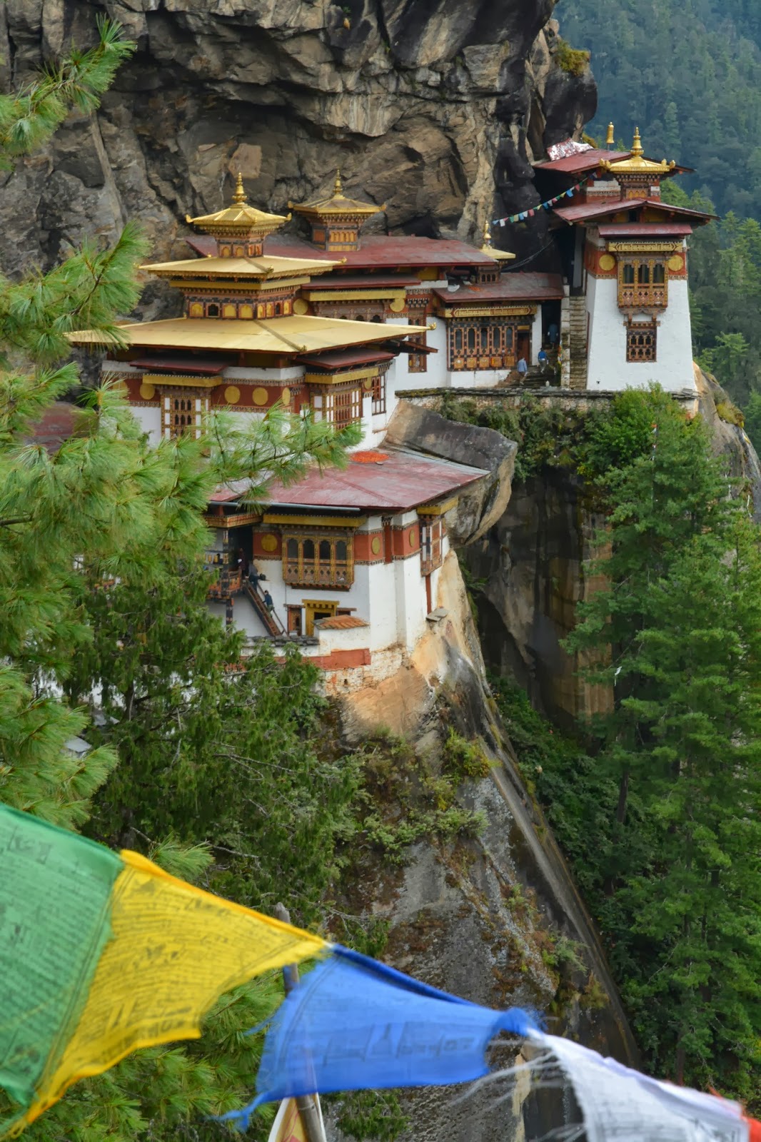
Today we did our first hike of the trip to Taktsang or the Tiger's Nest.  This monastery was first built in 1692 on a set of cliffs high above the Paro Valley.

Taktsang or The Tiger's Nest

Legend has it that the site was selected because it was here that Guru Rinboche who brought Buddhism to Bhutan meditated in a cave for 3 years back in the 8th century.  The Guru flew to the site from Tibet on the back of a tigress, hence the name The Tiger's Nest.

Sadly, a fire destroyed the monastery back in 1998, 6 years after our first visit.  Fortunately, it has been rebuilt to its former glory.  This time we were able to go inside the monastery and visit a few of the temples.  Photography isn't allowed so we don't have any photos of the interior.

Us with Taktsang in the Background

Tomorrow we start our 26-day trek in Bhutan considered by some to be possibly the greatest trail on Earth.  The "Snowman Trek" follows the spine of the Himalaya between Bhutan and Tibet.  Here is a  map of our trek route.

Trek Route in Red

During our 26 days we will cross 11 passes over 15,000 feet 5 of which are over 16,000 feet..  We will visit the almost separate mountain kingdom of Lunana, one of the remotest inhabited valleys in the world.  Internet access will be limited but I will try to give a few updates over the course of our journey.

We hope all is well back home,  
Peggy and Marc

Saturday, July 27, 2013

"Don't Worry", it's Just a Rhino!

Greetings All,
From the top of the Grootberg Plateau you can see the Klip River Valley below and see Hartman's mountain zebra and oryx grazing on the scant vegetation.  I couldn't wait to get down there.

Peggy Viewing the Klip River Valley

At 6:00 AM the next morning we headed down along with our guide, two trackers and five other guests to track the desert-adapted black rhino.  It's hard to imagine that rhinos and elephants can survive in such a harsh environment but they do.  I spotted a lone bull elephant browsing on a Mopane tree.

Desert Elephant Bull

The trackers spotted fresh rhino tracks and headed out on foot to track them.  They radioed us to let us know that a rhino had been spotted in the Mopane thicket about two km away.  We followed the guide in single file to the location and preceded cautiously toward the rhino.  At first I couldn't see her but then her gray shape appeared in the bush.  As I looked through my binoculars I could see a second rhino. Our trackers told us that this was Mercy and her calf Lorenzo.

Mercy, a Black Rhino Cow

We approached to within 30 meters as the rhinos were hidden safely in the bush and weren't apt to come out.  After viewing them for about 20 minutes it was time to head back.

Our next stop was Desert Rhino Camp operated jointly by Wilderness Safaris and Save the Rhino Trust.  The following day Marc and I had a private rhino tracking tour.  We headed out with our guide and three trackers to a more remote location within the 1.1 million acre conservancy in search of rhinos that have not been seen in awhile.  Our trackers picked up fresh tracks and followed them. We watched from the vehicle as they flushed a beautiful cow from a ravine below.  We were in much more open country so were only able to approach her to within 80 meters on foot.  Her name is Musona which means "The Lady" in the local language.  Unfortunately her calf died about a month ago.

Musona, a Black Rhino Cow

What a privilege to be so close to such a rare creature, one of the last free roaming black rhinos on the planet!  Save the Rhino Trust and Wilderness Safaris are working hard to protect these rhinos and so far have been very successful.

The next morning we went tracking again with a large group.  The trackers found another rhino sleeping and again we approached cautiously.

Sleeping Black Rhino

We had seen what a sleeping rhino can do if awoken suddenly.  About a week ago, two guests were driving into camp along with their guide.  As they went around a bend they startled a sleeping rhino, Speedy, and he charged the vehicle piercing the body with his horn inches from where one of the guests was sitting!

Speedy rams one of the Land Rovers

Our trackers told us to sit while he woke up this rhino.  "Wait a minute you want to wake a sleeping rhino up while are sitting only 50 meters away?" I asked.  The tracker replied "This rhino isn't Speedy, his name is Don't Worry and he is very relaxed".  The tracker walked around Don't Worry and he awoke from his slumber.  He got up slowly to his feet watching the tracker then turned his attention toward us.  He looked at us but did not approach.

Don't Worry, a Black Rhino Bull

What a thrill!  I wasn't worried about Don't Worry attacking us.  I'm more worried about greedy humans invading this remote wilderness and poaching these magnificent creatures.  I hope this never comes to pass.

In addition to seeing the rhinos we were very lucky with seeing desert elephants.  We were fortunate to come across three breeding herds, a rare site in this arid environment.   The elephants have to travel long distances to find enough food and water to sustain them.

Desert Elephants

On our last game drive we were on our way to a sundowner spot when we encountered a beautiful male lion sitting next to the road - a rare site indeed!  Lions are often heard but rarely seen in this vast landscape. 
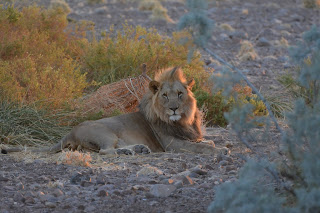
Male Lion

We left Desert Rhino Camp the next day and stopped at Twyfelfontein to see ancient rock engravings made by the San People 2000 to 6000 years ago!  We visited here 11 years ago but our stop was brief.  The area is now a World Heritage Site and we were able to see more panels including this one containing the famous "Lion Man", a creature with human toes, an overly long tail with a rectangular kink and a pugmark at its tip.  It was most likely created as part of a shamanistic ritual.


"Lion Man" Panel at Twyfelfontein

We are currently in the Erongo Mountains getting ready for the drive back to Windhoek.  The Erongo wilderness has been a pleasant surprise with beautiful landscapes, loads of rock hyrax and stunning birds.  Some photos follow.

Erongo Mountains

Rock Hyrax


Rosy Faced Lovebird

Tomorrow we fly home arriving back Monday morning.   That's all from Namibia.  Until our next adventure stay well.
Peggy and Marc


      Namibia Mammal List: May 23 - July 29, 2013

 No. Species Scientific Name Notes
  1 African Bush Elephant Loxodonta africana Etosha, Kunene (desert  adapted)
  2 Black Rhino Diceros bicornis  Etosha, Kunene (desert  adapted)
  3 Southern White Rhino Ceratotherium simum simum Etosha 
  4 Southern African Lion Panthera leo melanochaita Etosha, Kunene 
  5 Angolan Giraffe Giraffa giraffa angolensis Etosha, Kalahari Red Dunes 
  6 Eland Tragelaphus oryx  Kalahari Red Dunes, CCF,  Etosha 
  7 Black-backed Jackal  Canis mesomelas  CCF, Etosha 
  8 Spotted Hyena Crocuta crocuta Etosha 
  9 Aardwolf Proteles cristata CCF
 10 Aardvark  Orycteropus afer  CCF
 11 Temminck's  Ground Pangolin Smutsia temminckii  CCF
 12 Southern Greater Kudu Tragelaphus  strepsiceros strepsiceros  CCF, Bagatelle, Fish River  Canyon 
 13 Common Warthog  Phacochoerus africanus  CCF
 14 Plains Zebra Equus quagga CCF
 15 Hartman’s Mountain  Zebra Equus zebra hartmannae Kunene 
 16 Southern Ground  Squirrel  Xerus inauris CCF
 17 Steenbok Raphicerus campestris Kalahari Red Dunes, Etosha 
 18 Springbok Antidorcas marsupialis  Etosha 
 19 Black wildebeest Connochaetes gnou  Kalahari Red Dunes
 20 Angolan Klipspringer  Oreotragus oreotragus typicus  Kunene, Fish River Canyon
 21 Gemsbok  Oryx gazella Etosha, Bagatelle 
 22 Slender Mongoose Herpestes sanguineus CCF
 23 South African  Porcupine  Hystrix africaeaustralis CCF
 24 Rock Hyrax Procavia capensis Erongo
 25 Blue Wildebeest Connochaetes taurinus  Bagatelle
 26 Red Hartebeest Alcelaphus buselaphus caama CCF
 27 Yellow Mongoose Cynictis penicillata CCF
 28 Springhare Pedetes capensis  Bagatelle

Friday, July 26, 2013

Stay in the Croc or be Eaten by One!

Greetings All,
After leaving Etosha National Park we headed north to visit an Owambo homestead at Ongula.   The Owambo are pastoralists grazing their herds of goats and cattle and growing mahangu.  Mahangu or pearl millet is the staple food of the north-central regions of Namibia.  

Owambo Woman Pounding Mahangu

Able to grow in low-rainfall, high temperatures and low soil fertility, it is eaten in a variety of dishes and drinks, and the stalks are used to feed cattle and thatch roofs. Once grown, harvested and threshed, the mahangu is stored in giant baskets made of Mopane branches.

Basket for Storing Mahangu
 
That night were were treated to a song and dance performance by the local girls.

Owambo Girls Singing and Dancing


We continued our journey north and then to the west to the Kunene River which forms part of the northern border with Angola.  After not seeing flowing water for nearly two months it was a treat to cruise on the Kunene River.  We stopped on the northern shore (Angola) to take in another magnificent African sunset.

Marc and Peggy on the Kunene River
 
The next day I got up the nerve to go white water rafting.  The rapids weren't big, maybe class I- III but with a twist, we were to paddle our own two-man raft, called a croc through them!

Peggy next to our "Croc"


I was determined to stay in the boat as giant Nile crocodiles ply these waters.

Nile Crocodile
 
Our guides told us that crocodiles didn't like rapids. I hoped they were right.  We were assured that the rapids were easy but when we had to carry our raft over rocks to a canyon just above a waterfall and be lowered 10 feet over the rocky edge to the river below I wasn't sure what we had gotten ourselves into!  Once on the river we had to avoid going over the twenty foot waterfall which we managed to do. Now, the fun began...  We made it through the first two rapids without too much trouble.  On the third rapid we ended up going down backwards.  When we got to the forth, I had lost faith in Marc's navigational abilities and bailed into one of the guide's boat while Marc bailed into another.  We made it through the fourth rapid but the guides made us get back into our boat for the fifth rapid.  They warned us to avoid the big rock in the middle but failed to warn us of a second rock which we managed to get stuck on.  One of the guide boats had to come rescue us.  The sixth rapid was fairly straightforward and we made it through without incident.  We got out of the boats to check out the seventh and most difficult rapid.  It was class IV.  There was no way I was going down it in a two-man raft with Marc at the helm!  We watched the guides negotiate  the rapid, the first losing his passenger, a teenager from Belgium.  The second boat made it through with another daring teenager. We walked around the rapid with the teenagers' mother.  She was worried seeing her son pop out of the boat and go bobbing down the rapid but he ended up with only a few scrapes.  I wish I had my camera to document our journey down the river but we didn't want to get it wet so we only have one photo of us padding on flat water.

Us Paddling Toward Shore

Somehow we managed to make it through six out of the seven rapids without going overboard. While we were loading the rafts onto the trailer, a Himba girl and her brother out herding goats, came to the river to drink.

Himba Boy and Girl

The Himba are traditionally nomads, traveling long distances to find suitable places to graze their goats and cattle.  The previous day we visited an elderly couple and their 10 year old daughter at their homestead near by.  Their home was built out of sticks and mud.

Himba Family next to their Hut
 
We ducked inside to learn a bit more about how they live.  Living in an area with little rainfall, the Himba rarely bathe.  Instead they coat their bodies with otjize, a mixture of ochre, animal fat and herbs.  It protects their skin from the sun and insects and provides some insulation from the winter cold.

Himba Woman applying Otjize


All of their few belongings are made from leather, scrap metal or gourds.  The married women braid their hair and wear a leather headdress and not much else.  When they get married, they wear a sort of apron decorated with cowrie shells.

Himba Belongings including a Pillow in the lower Right
 
After our visit to the Kunene Region we headed south towards the Grootberg Plateau.  
We hope all is well back home.
Peggy and Marc